Most visitors to Belize turn west for Cayo or south for the cayes, which is exactly why driving to Corozal Belize feels like a different country. This is the far north: sugar cane and sea grape, Spanish spoken as often as Creole, a seafront boulevard with no cruise crowds, and a small Maya site sitting on a rise at the edge of town. The border with Mexico is only a short drive further on, and Chetumal's lights are visible across the bay at night.
It is also one of the easiest long drives in the country. The highway is paved the whole way, the towns are spaced out sensibly, and the only real traffic hazards are cane trucks and the speed bumps that guard every village.
How long is the drive to Corozal Town?
From Belize City, Corozal is roughly two to two and a half hours north on the Philip Goldson Highway, depending on how often you stop and whether the cane harvest is running. From San Ignacio it is a longer day, generally in the four-hour range, because you first have to cross the country west to east before turning north.
If you are coming from Cayo or Belmopan, you do not need to drive into Belize City at all. The Burrell Boom Road leaves the George Price Highway near Hattieville and cuts north to rejoin the highway well above the city. It saves time, avoids city traffic, and passes close to the Community Baboon Sanctuary at Bermudian Landing, which makes a good leg-stretch if you are starting early.
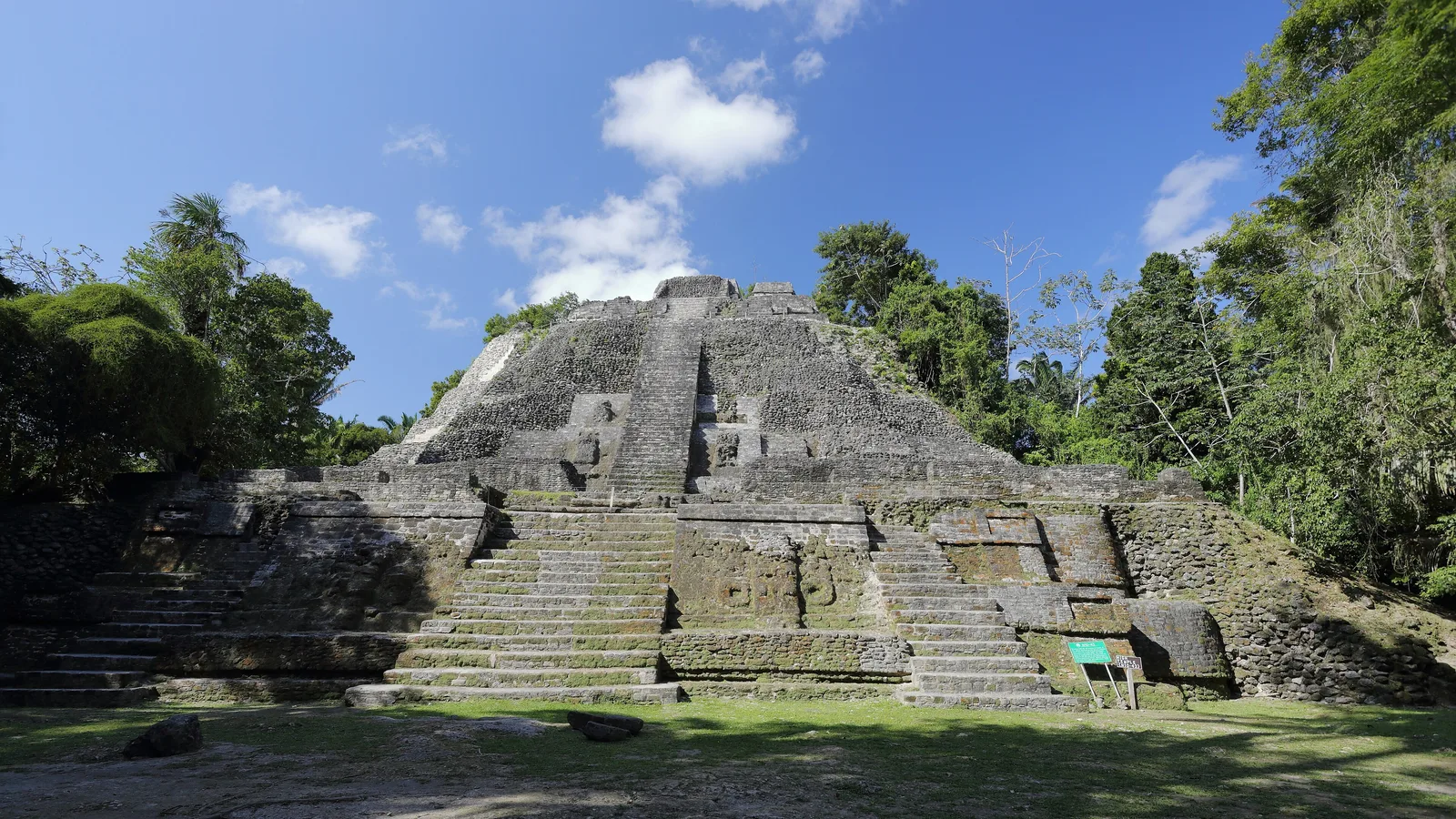
North of there the road runs through Orange Walk Town, the heart of sugar country. It is worth pulling off for an hour. The central park area is the place to find tacos and garnaches in the evening, and the Tower Hill bridge over the New River just south of town is where you will see boats heading upriver towards Lamanai.
What are the roads actually like?
The Philip Goldson Highway is two lanes of decent asphalt with occasional patched sections and roadworks. The things to plan for are:
- Cane trucks. During harvest, roughly the dry-season months, heavily loaded trucks move slowly and shed cane stalks onto the road. Overtake only with a long clear view.
- Speed bumps. Every village has them, often unpainted and unsigned. Slow right down when houses appear.
- Cyclists and pedestrians. Shoulders are narrow and people walk on the road edge at dusk. Avoid driving after dark if you can.
- Fuel. Stations are common in Orange Walk and Corozal, thinner in between. Top up in the towns rather than gambling on a village pump.
- Police checkpoints. Routine and polite. Have your driving licence and the rental paperwork in the glovebox.
For the highway run itself, any of our comfortable mid-size SUVs will do the job well. A 2017 Jeep Cherokee is an easy long-distance drive with air conditioning that copes with the northern heat, and the Jeep Patriots and Compasses across the fleet handle the same route happily. Where clearance starts to matter is on the side roads out to Cerros and Sarteneja, covered below.
Santa Rita: the ruins above Corozal Town
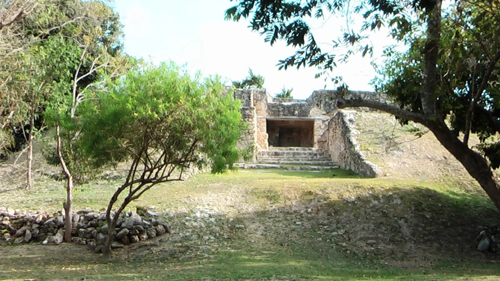
Santa Rita sits on high ground at the northern edge of Corozal, a few minutes from the town centre past the hospital. You can drive almost to the gate and park on the grass. What you see today is modest: one restored stone structure you can climb, a cleared lawn, trees, and a caretaker who will usually come over for a chat. A small entrance fee is collected at the site, so carry some Belize dollars and check the current rate when you arrive.
The modesty is deceiving. Archaeologists generally identify Santa Rita with the ancient town of Chetumal, a trading centre that controlled the mouth of the New River and the Rio Hondo, and the corridor of cacao, honey and salt that ran up the coast. It was occupied for an unusually long stretch, from the Preclassic right through to the arrival of the Spanish, which makes it one of the few places in Belize where Maya life and European contact overlap in the same ground.
In the 1890s the physician and amateur archaeologist Thomas Gann recorded painted murals here in a style with strong Mexican highland connections. The paintings themselves did not survive, but his drawings did, and elite burials found at the site included jade and mica ornaments. Modern Corozal has grown around and over much of the rest of it.
Give it an hour. Climb the structure for the view over the bay, then head down to the seafront.
What else is there to see in Corozal Town?
Corozal was founded in the mid-1800s by refugees from the Caste War in Yucatán, and it was flattened by Hurricane Janet in 1955, which is why the town looks newer than its history. Two stops are easy and free or near-free:
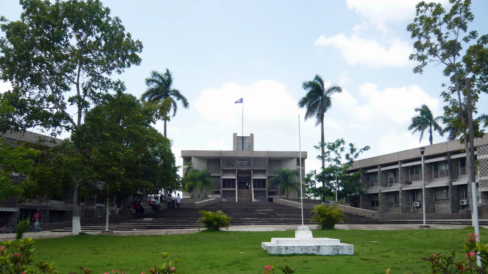
- The Town Hall mural, painted by Manuel Villamor Reyes, a vivid telling of Corozal's history from the Maya through the Caste War. Ask at the desk about viewing it.
- The Corozal House of Culture, in the handsome old market building near the sea, with rotating local exhibitions.
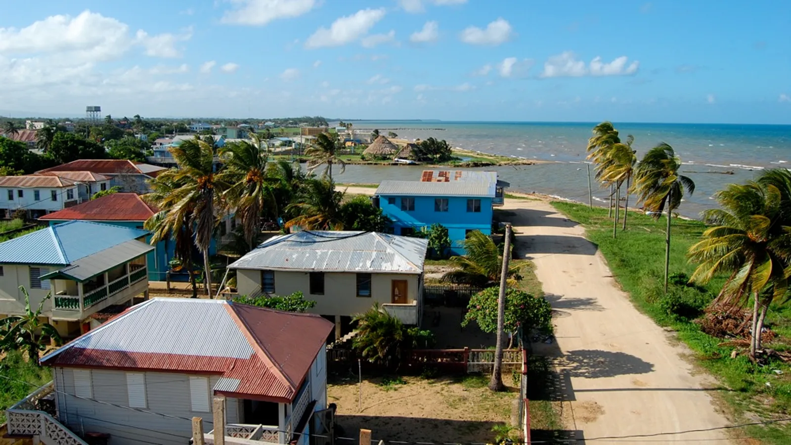
- The seafront, where the bay is shallow, calm and lined with benches and almond trees. This is the town's living room in the late afternoon.
North of town the road continues to Consejo and to the border crossing at Santa Elena, with the Corozal Free Zone sitting just before the immigration post. Rules about entering the Free Zone change, so ask locally before driving in.
Cerros, Copper Bank and the road to Sarteneja
Across the bay from Corozal, the Preclassic site of Cerros (Cerro Maya) sits right at the water's edge near Copper Bank Village, with temple platforms looking straight out over the sea. Some visitors cross by boat from Corozal. By road it is a longer loop south and east on unpaved roads that involve a hand-cranked ferry crossing, and the surface can deteriorate badly after heavy rain. Ask in Corozal about current conditions before committing, and do not attempt it late in the day.
The same general area leads on to Sarteneja, a fishing and boatbuilding village on the north coast, and the Shipstern area of lagoons and forest behind it. These are genuinely rural roads: dirt, potholes, occasional soft patches. A small SUV with decent ground clearance such as a Jeep Compass is a sensible minimum, and if there are more of you, the eight-seat Ford Expedition handles rough surfaces with room for everyone's bags.
Plan for before you go
- Belize dollars in small notes for site fees, ferries and roadside food
- A full tank leaving Orange Walk if you are heading off the highway
- Sun hat, water and insect repellent, especially near the lagoons
- Offline maps, since mobile signal is patchy on the Copper Bank and Sarteneja roads
- Your passport if there is any chance you will go near the border zone
- An early start, so the return leg is finished before dark
If this is your first time driving here, our general notes on travelling in Belize cover entry requirements, licences, currency and the rhythm of the roads.
Making it a two or three day trip
Corozal rewards an overnight. Drive up in the morning, do Santa Rita and the seafront in the afternoon, sleep in town, then take the rougher road out to Cerros or Sarteneja the next day with time to spare. On the way back south, Orange Walk is the obvious base for a Lamanai river trip.
We rent with unlimited mileage within Belize and third-party insurance included, and we can hand the vehicle over in San Ignacio, at the international airport, in Belize City, or in Corozal itself if that suits your route better. Questions about which vehicle fits your plans are always welcome on the phone or WhatsApp through our contact page.
When you are ready, send us a reservation request. There is no online payment and no booking fee, and one of the family will come back to you with availability and price. The north is quiet. That is the whole point of it.
Frequently asked questions
How long does it take to drive from Belize City to Corozal?
Allow roughly two to two and a half hours on the Philip Goldson Highway, depending on traffic, roadworks and how many cane trucks you meet during harvest season. From San Ignacio it is usually around four hours, and the Burrell Boom Road shortcut lets you bypass Belize City entirely. Drive the return leg in daylight if you can, as village speed bumps and roadside pedestrians are hard to see after dark.
Can you drive right up to the Santa Rita ruins?
Yes. Santa Rita is at the northern edge of Corozal Town, a few minutes from the centre on paved and then local streets, and there is space to park near the gate. A small entrance fee is collected at the site, so carry Belize dollars and confirm the current rate when you arrive. Opening times are managed locally, so it is worth asking at your hotel before heading up.
Do I need a 4x4 to reach Cerros and Sarteneja?
The highway to Corozal is paved throughout and needs no special vehicle. The roads out to Copper Bank, Cerros and Sarteneja are unpaved, include a hand-cranked ferry crossing, and can become difficult after heavy rain, so ground clearance matters there. Ask locally about current conditions before setting off, and avoid attempting the loop late in the day.
Can I take a rental vehicle across the border into Mexico?
Cayo Auto Rentals vehicles may be taken into Guatemala for Tikal with prior written consent from the office. For any other border crossing, including the Mexican border near Corozal, contact the family directly before you travel rather than assuming it is permitted. Rules around the Corozal Free Zone also change, so check locally before driving in.