Driving in Belize is easier than most first-time visitors expect. The country has four main highways, very little traffic by regional standards, and signage in English. What catches people out is not the driving itself but the small local habits: the speed bumps that appear without warning, the single-lane bridges, the roundabouts in Belmopan, and the fact that nobody uses street addresses. Learn those and the rest of the country opens up.
Here is what we tell every family that picks up a vehicle at our office on Benque Viejo Road in San Ignacio.
The basics before you turn the key
Belize drives on the right, like the United States, and most vehicles are left-hand drive. Distances and speed limits are posted in miles, fuel is sold by the US gallon, and prices are quoted in Belize dollars (fixed at two to one against the US dollar). If you want the wider practical picture on entry requirements, licences and currency, our Belize travel information page covers it.
The highway network is simple enough to memorise:
- George Price Highway — Belize City west through Belmopan and San Ignacio to the Guatemalan border at Benque Viejo.
- Philip Goldson Highway — Belize City north through Orange Walk to Corozal and the Mexican border.
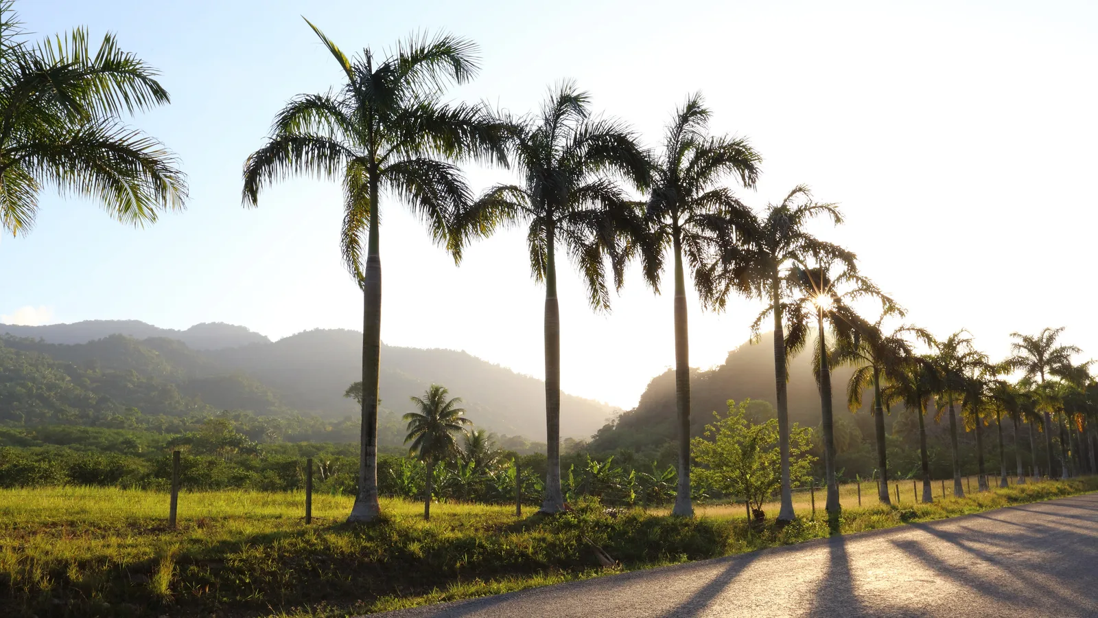
- Hummingbird Highway — Belmopan south-east to the Stann Creek valley. Hills, curves, limestone karst scenery, and widely considered the prettiest road in the country.
- Southern Highway — from the Hummingbird junction down through Independence to Punta Gorda in Toledo.
- Coastal Road (Manatee Road) — a shortcut between the Belize City area and Dangriga that has been undergoing upgrades; conditions vary, so ask locally before committing to it.
Everything else branches off these. Addresses along them are given by mile marker: "Mile 31 on the Hummingbird" is a real and perfectly usable direction.
What are Belizean speed bumps like?
This is the single most important thing to know. Belize uses speed bumps heavily, and they are serious. Locals call them bumps or sleeping policemen, and they come in a few flavours: wide paved humps at village edges, sharp narrow ridges near schools, and the dreaded unpainted ones that blend into worn asphalt.
They are usually, but not always, signposted. On the Philip Goldson and George Price highways, assume a set of bumps at the entrance and exit of every village. Slow to a crawl. Hitting one at highway speed can damage a suspension, and recovery in a rural area takes time.
The practical habit is simple: when you see houses, a church, a school or a cluster of shops on either side of the road, lift off the accelerator before you see the sign.
Speed limits and police checkpoints
Posted limits are generally around 55 mph on open highway stretches and much lower through villages and towns, often 25 mph or less. Limits are signposted and worth respecting, as enforcement does happen.
You will also pass occasional police checkpoints. These are routine. Slow down, stop if waved down, lower your window, be polite and have your driving licence and the vehicle paperwork to hand. Our rental vehicles travel with their documents, and we go through what is in the folder when you collect the keys. Checkpoints are usually a thirty-second conversation.
Roundabouts, junctions and one-lane bridges
Belmopan has several roundabouts, and there are others around Belize City and on the approaches to a few towns. The rule is the standard one: traffic already in the roundabout has priority, and you give way to the right as you enter. In practice, local drivers signal inconsistently, so make eye contact and move decisively rather than hesitating in the entry lane.
One-lane bridges are common on secondary roads and on some highway stretches. The convention is that the first vehicle to reach the bridge goes, and the other waits. There is rarely a sign spelling this out. Flash your headlights once to say "come ahead" if you are the one waiting — a flash in Belize is usually an invitation or a warning, not an act of aggression.
A few other unwritten courtesies worth knowing:
- A left indicator on the vehicle ahead on an open highway often means "it is safe to pass", not "I am turning left". Treat it as advice, not a guarantee, and check for yourself.
- A hand out of the window, palm down and patting the air, means slow down — usually because of a hazard ahead.
- Buses stop anywhere. Give them room and do not try to squeeze past as passengers are getting off.
- Cyclists, dogs, horses and the occasional cow all use the shoulder. Pass wide.
Where do you buy fuel in Belize?
Fuel stations are in every town and most larger villages, concentrated along the main highways. Stations are attended, so you do not pump your own: pull up, tell the attendant how much you want and which grade, and they handle it. A small tip is appreciated but not expected. Many stations take cards, but cash in Belize dollars is always safer in rural areas.
The rule of thumb for touring is to never let the tank drop below a quarter. Long stretches of the Southern Highway, the back roads of Toledo, the Coastal Road and the roads into Mountain Pine Ridge have no fuel at all. Fill up in San Ignacio, Belmopan, Dangriga, Independence or Punta Gorda before heading into those areas.
Plan for before a long driving day
- Download offline maps — mobile coverage drops out in the hills and the far south.
- Cash in small Belize dollar notes for fuel, tolls at the borders and roadside fruit.
- A full water bottle each and some snacks; stretches between villages can be long.
- Your licence and passport, kept somewhere you can reach at a checkpoint.
- A spare phone charger and a cable, since the vehicle is your only reliable power.
- A rough plan to be off the highway before dark.
Is it safe to drive at night in Belize?
Driving after dark is the one thing we genuinely discourage. The problem is not crime so much as visibility. Highways are mostly unlit, speed bumps are hard to spot, cyclists ride without reflectors, and animals wander onto the road. A pothole you would steer around easily at noon becomes invisible at nine in the evening.
Plan your days so the longer legs happen in daylight. Belize is a small country and almost any two points can be linked in a few hours, so there is rarely a reason to push through the night.
Which vehicle suits Belizean roads?
The four main highways are paved and perfectly comfortable in any car. The moment you leave them — the climb into Mountain Pine Ridge, the limestone track to a cave, the village roads of Toledo, the turn-offs to beaches and river landings — ground clearance starts to matter, and after rain it matters a lot.
That is why our fleet is built around SUVs rather than compact cars. A five-seat SUV such as the 2017 Jeep Cherokee handles the ruts and crossings comfortably while still being easy to park in San Ignacio, and larger groups can move up to a seven or eight-seat SUV or the twelve-seat van. All rentals include third-party insurance and unlimited mileage within Belize, and we deliver and collect anywhere in the country, including the international airport.
If something does go wrong on the road, we also run towing and recovery, so you are calling a family that can actually come and help rather than an overseas call centre.
One road worth a specific mention is the Coastal Road between the Belize District and Dangriga, which cuts a good deal of distance off the drive south. Our guide to Gales Point Manatee covers what that route is like and the lagoon village halfway along it.
Ready to drive it yourself
Once you have the rhythm of it — slow through villages, fuel early, daylight only, wave at the bridge — driving in Belize becomes one of the best parts of the trip. You stop where you want, you reach places the shuttles skip, and you set your own clock.
Tell us your dates and where you would like to collect the vehicle and we will confirm availability and price by phone or email. Send a reservation request and our family will take it from there.
Frequently asked questions
Which side of the road do you drive on in Belize?
Belize drives on the right-hand side of the road, the same as the United States and Mexico, and most vehicles are left-hand drive. Distances and speed limits are posted in miles. If you are comfortable driving in North America, the basic mechanics will feel familiar straight away.
Do I need a four-wheel drive to travel around Belize?
For the four main highways, no — they are paved and suit any vehicle. Ground clearance becomes important as soon as you take unpaved turn-offs to caves, waterfalls, Mountain Pine Ridge or village roads in Toledo, especially after rain. An SUV is the safest all-round choice for a touring itinerary.
Can I take a rental vehicle from Belize into Guatemala to visit Tikal?
Yes, vehicles from Cayo Auto Rentals may be taken into Guatemala with prior written consent from us. Arrange it before your trip so the paperwork is in order when you reach the border at Benque Viejo. Mention it when you send your reservation request and we will explain what is needed.
Is it safe to drive at night in Belize?
We advise against long night drives, mainly for visibility reasons. Highways are largely unlit, speed bumps and potholes are hard to see, and cyclists, dogs and livestock often use the road shoulder after dark. Plan to complete longer legs in daylight.